


Reports, Maps & Data
Turtle Cove submits an annual report describing its activities and how many people were served through education, outreach, and research activities. We've also provided a list of relevant maps for the region.
Annual Reports
FY 2005/06 - 2006/07 Biennial Report [post-Katrina]
FY 2007/08 - 2008/09 Biennial Report
Downloadable Maps
To save these images to your hard drive, right-click the link and select "Save target/link as". To view a file, left-click the link. We also have larger TIFF versions of these images if you would like to use them. Send an email request to Rob Moreau [rmoreau@southeastern.edu], and we will get them to you via CD.
Western half of Lake Pontchartrain (JPG, 9.5MB)
Black and white image includes portions of Lake Maurepas, the cities of Mandeville and Ponchatoula, and the lakeshores of Metairie and Kenner
Colorized image of the Manchac WMA (JPG, 5MB)
Links to Maps
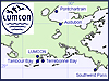 Lake Pontchartrain Data | Lake Pontchartrain Field Station Info
Online monitoring of water quality and weather data in the Lake Pontchartrain Basin
provided through a partnership of LUMCON, Tulane, and Turtle Cove.
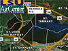 Manchac Weather Monitoring Station at Turtle Cove
Weather data for Manchac region provided through a partnership of LSU Agri-Climate
Center and Turtle Cove. Unfortunately, this station has been inactive since Katrina;
however, it is scheduled to return Fall of 2010. Select the Manchac weather monitoring
station, and view the current data or create graphs showing long-term trends of the
data.

Images that illustrate the problems of coastal erosion and wetland loss. Images are in many different forms, including GIS, AVHRR, and aerial.
 National Wetlands Research Center
Wetland maps, information, and animations of wetland loss projections.